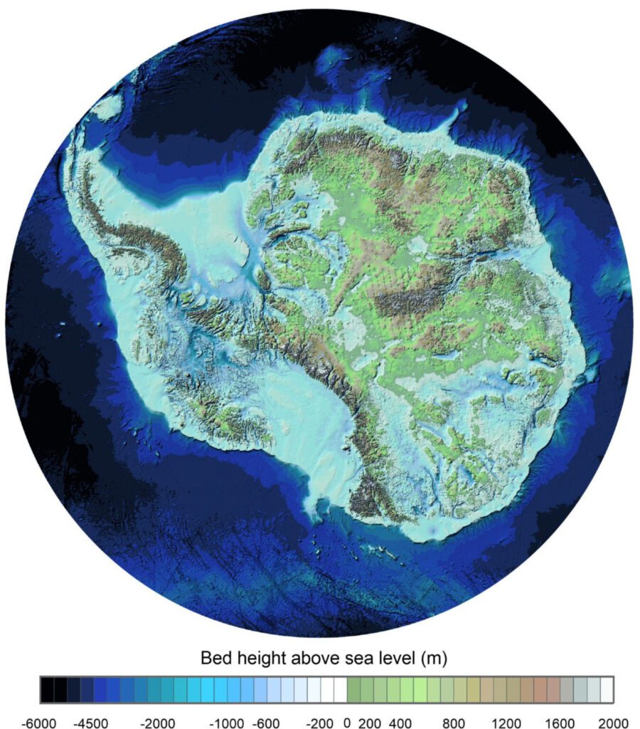
A team of international scientists has developed a comprehensive map of Antarctica’s topography beneath its ice, utilizing over 60 years of data gathered from various sources, including planes, satellites, and exploratory expeditions. This new map, known as BedMap3, released by the UK Antarctic Survey (BAS), provides a detailed view of the continent as if the ice were removed, revealing hidden features like tall mountains and deep canyons.
The release comes amid growing concerns about climate change and the significant loss of Antarctic sea ice, which has been increasing in recent years. BedMap3, an update from the previous BedMap2 published in 2013, doubles the data points used previously, allowing for a more accurate representation of the Antarctic landscape. Notably, a reinterpretation of data has identified the thickest ice in a previously unnamed canyon rather than the previously thought Astrolabe Basin.
The map’s findings indicate that Antarctic ice sheets are thicker than previously detected, revealing that ice rests on a rock base, making the continent more vulnerable than once believed. Experts emphasize that this information is crucial for understanding ice flow and the effects of rising temperatures on Antarctica. Recent estimates show Antarctica losing about 150 billion tons of ice annually, further underscoring the map’s significance in climate research.
Source link


