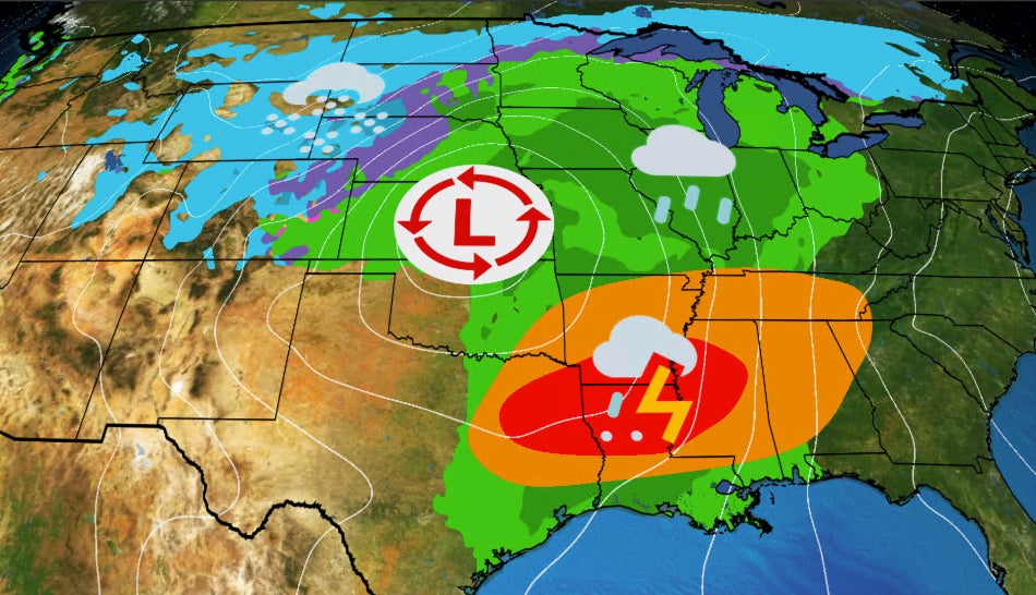
A significant weather outbreak is anticipated next week across the southern United States due to a powerful low-pressure system, which could result in tornadoes, torrential rains, and even wet snow in the central and eastern regions. From Tuesday to Wednesday, the system is expected to draw warm, humid air, potentially leading to severe thunderstorms from Texas to the Tennessee Valley. According to NOAA’s Storm Prediction Center, areas susceptible to severe weather may be highlighted, with concerns for intense convection, including supercells and squall lines.
The severe weather risks may extend into Wednesday, particularly from Virginia to Georgia, with potential for damaging winds and tornadoes. Additionally, heavy rainfall is predicted in parts of Ohio, Mississippi, and the Tennessee Valley, raising flash flood concerns. Wind gusts associated with thunderstorms could cause power outages and tree damage, primarily in the eastern areas on Wednesday.
As the system also brings snow from the Rockies to parts of the Great Lakes, further monitoring of the evolving weather situation is advised. Residents are urged to have a safety plan ready and stay updated on warnings from the National Weather Service. Jonathan Erdman, a senior meteorologist at Weather.com, is covering this potential severe weather event.
Source link


